1. Sunset and sunrise and the SERA definition of night
Finnish time today, 16.07.2026 - Night ends: 02:59 - Sunrise: 04:18 - Sunset: 22:23 - Night begins: 23:42
Times tomorrow - Night ends tomorrow: 03:03 - Sunrise tomorrow: 04:20 - sunset tomorrow: 22:21 - Night begins tomorrow: 23:39
2. General information:
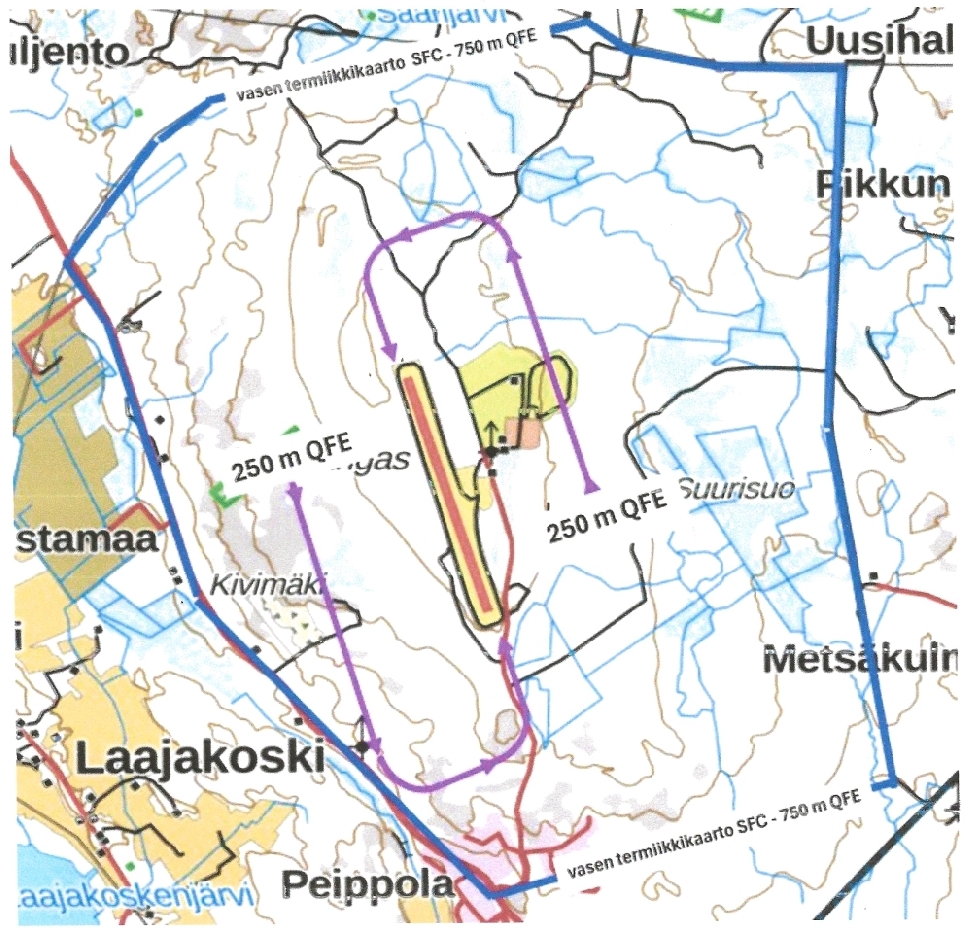
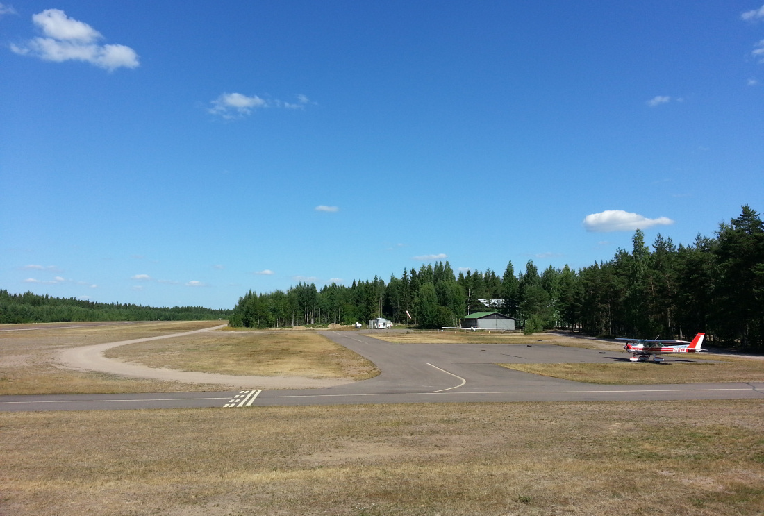
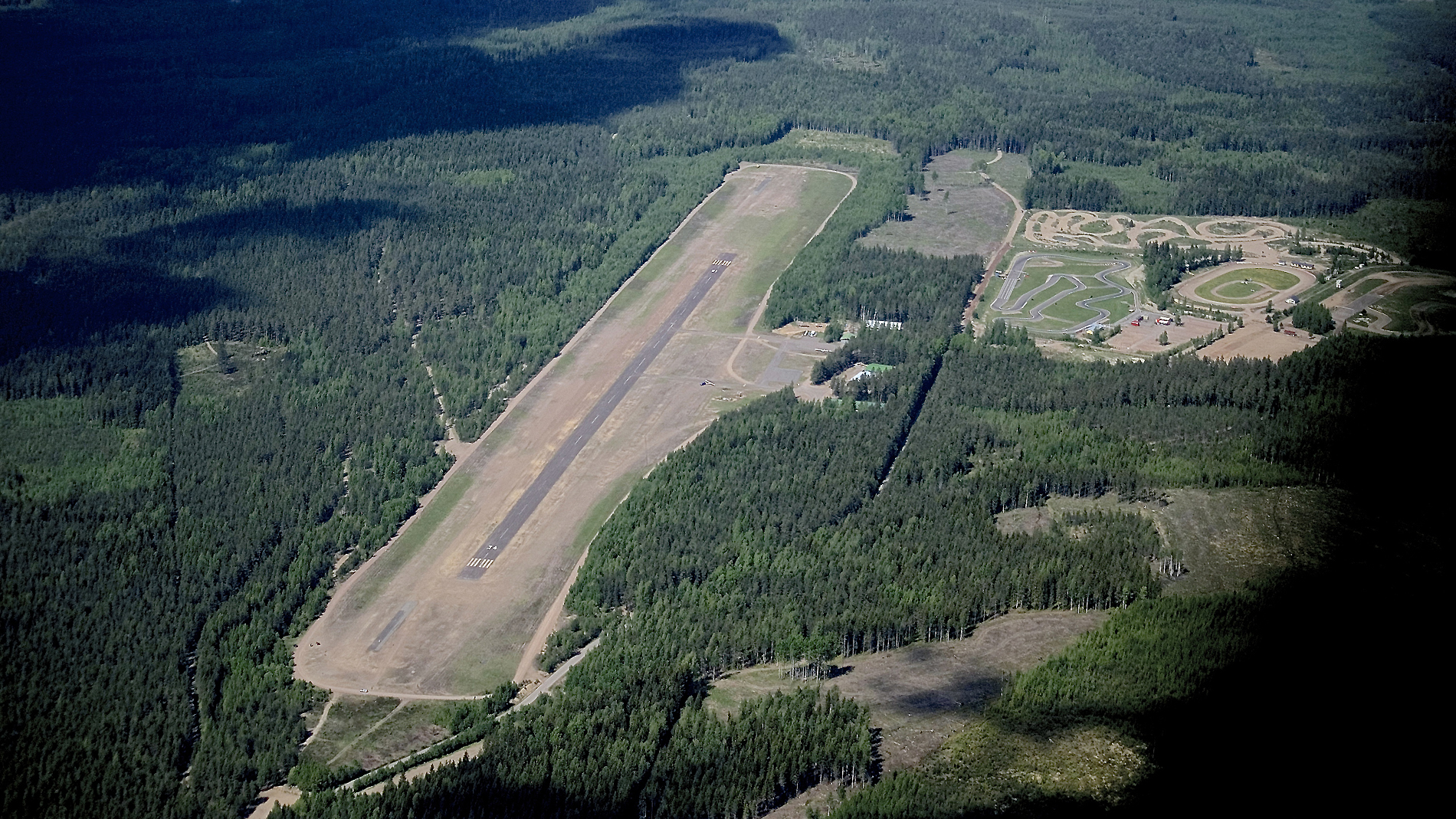
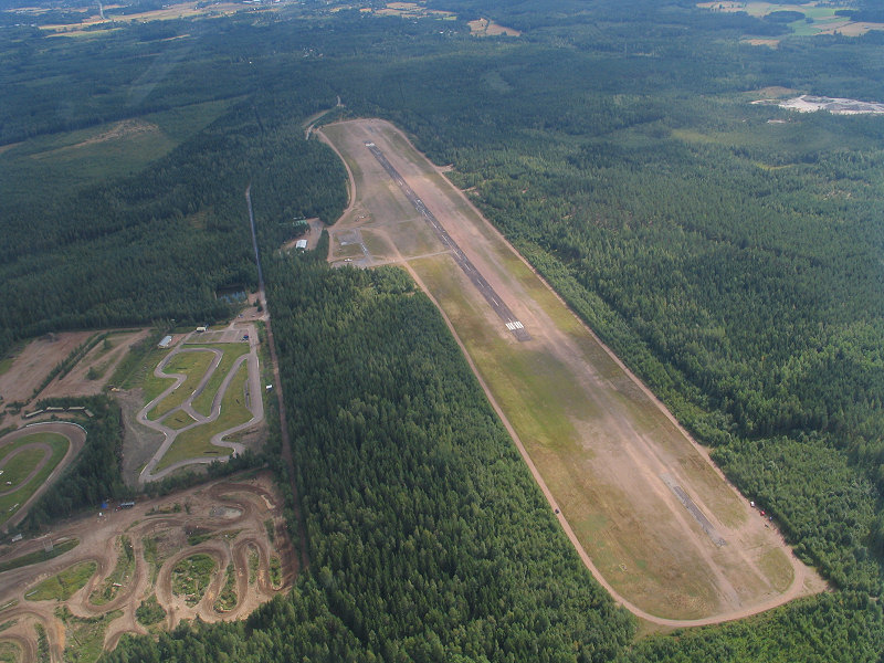
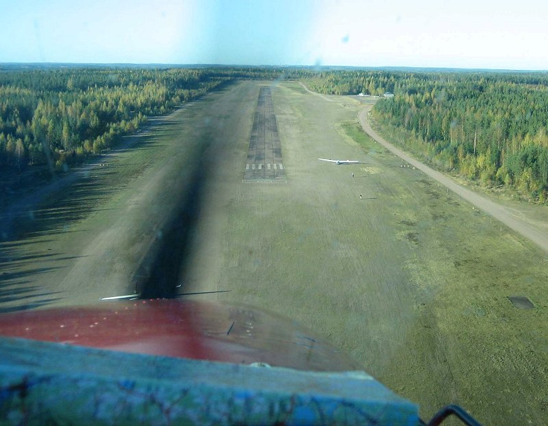
A lively gliding airport north of the city of Kotka. The Karhula Aviation Club is very active in the field, and the towing method used is a winch. This is worth noting. There is also a Kotka Aviation Club for motor flying and a few privately owned airplanes. There is a separate parking area for guest planes between the refueling point and the taxiway leading to the halls. The accommodation are old barracks, and therefore quite rudimentary. However, overnight stays are possible. Gliders operate at the ends of the field area, starting from small pieces of asphalt and landing right into the sand/grass. The tow wire rests on the ground on the west side of the runway and does not interfere with runway traffic. Distance to the center of Karhula town is about 7 km. When taking off from runway 16, it is desirable to complete the left turn as early as possible and thus avoid the village of Peippola, which is located about 1 km south of the field.
3. Price Information:
NIL
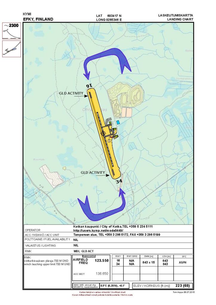
4. The Airport:
The paved runway is slightly bumpy and there are bumps here and there at the northern end of the asphalt section, the rest of the runway as well as the taxiways and parking area are in good condition. The runway environment is sandy and thus quite flat. Because the paved runway is located longitudinally in the center of the runway, there is approximately 200 meters of flat runway at both ends prior to the start of the edge zone. Pay special attention to the accumulation of capercaillies birds at the north end of the runway, especially in the early morning and late evening.
5. Basic data:
Coordinates: 603430N 0265338E Runway: 16/34 – 843 x 15 m – asphalt LDA: 16: 843 m, 34: 843 m Radio frequency: 123,550 Airport elevation: 68 m (223 ft) Fuel availability: Only used by Kotkan Ilmailukerho, no sales. Announcements:NOTAM
6. Sight seeing and services
Worth visiting is the aviation museum of the Karhula Ilmailukerho. Situated at the field, free entry. The Hamina city circular plan and the Hamina bastion some 20 km to the east are worth seeing from the air. The harbours of Hamina and Kotka, and t6he city of Kotka are interesting, too. Nearest restaurants are by the Karhula centre, some 7 kilometres distant.